
|
| Routes: Interstates US Routes State Routes: | Home |
| Routes 520-539 (500-519) Prev (540-559) Next |
Quick Links: Marked Unmarked
Decommissioned |
|
St. Mary's
|
MD 520
· Whites Neck Rd
2.61 mi.; from MD 239 south to road end
Marked north-south. ................... |
520
2.6 MD 2390.0 End |
|
Calvert
Huntingtown
|
MD 521
· Hunting Creek Rd
4.43 mi.; from beginning of state maitnenance northeast to MD 524.
Marked, unsure of signage directions ................... |
521
4.4 MD 5240.0 BSM |
|
Washington
Hancock
|
US 522
·
2.37 mi. in Maryland; from WV Line north to PA Line with I-70.
Marked north-south. US 522 has its own page in the US Highway section. |
|
|
Washington
Hancock
|
MD 523
· was Warfordsburg Rd
parallel east of US 522 to PA border
No longer assigned (decommissioned).
|
|
|
Calvert
Chaneyville
|
MD 523
· was Chaneyville Rd
from MD 4 west to end of state maintenace near Friday Creek
No longer assigned (decommissioned).
|
|
|
Calvert
Huntingtown
|
MD 524
· Old Town Rd
0.76 mi.; loop west off MD 2-4
Marked north-south. This was part of the original MD 2, bypassed by the new route to the east. |
524
0.8 MD 2-40.2 MD 521 0.0 MD 2-4 |
|
Calvert
Owings
Mt. Harmony |
MD 524
· was Grovers Turn Rd
~0.9 mi.; between Mt. Harmony Rd (then MD 260) and MD 2.
No longer assigned (decommissioned), number re-used for Old Town Rd.
|
524
0.8 MD 2-40.2 MD 521 0.0 MD 2-4 |
|
Calvert
Dunkirk
|
MD 525
· was Ferry Landing Rd
~1.1 mi.; from MD 4 west to end of state maintenance near Kaylorite St.
No longer assigned (decommissioned). ................... |
|
|
Carroll
Westminster
Finksburg Baltimore
Reisterstown
|
MD 526
· was Pennsylvania Ave, Main St, Old Westminster Pike
from MD 97-140 interchange north of Westminster southeast to MD 140 west of Reisterstown,
in 4 sections.
No longer assigned (decommissioned). MD 526 is the catch-all designation for all old sections of MD 140, Westminster Pike. Quite recently, the part near Reisterstown and the Pennsylvania Ave section in Westminster were active but unmarked. The Reisterstown section is used for access to Brian Daniel Ct and Woodland Ct from westbound 140, which is a de facto extension of I-795. The intersection is a traffic light with no turns off the mainline. Most of this route in Carroll County is still around, with breaks near Green Mill Rd and west of MD 91 where it crosses over current 140. |
|
|
Howard
Elkridge
|
MD 527
· was Bonnie View Rd
~0.1 mi.; north off US 1, Elkridge.
No longer assigned (decommissioned). ................... |
|
|
Worcester
Ocean City
|
MD 528
· Coastal Highway, Philadelphia Ave, S 1st St
9.04 mi.; from Ocean City Inlet north to Delaware
border.
Marked north-south. NHS: Entire length. The backbone of the barrier island that forms Ocean City. In the south below 15th St, 528 is one-way southbound. Northbound traffic is carried by one-way MD 378. This numbering strangeness may have resulted from a time that Coastal Highway wasn't complete end-to-end. MD 528 was completed sometime in the 1940s; prior to that, it was used for the northern part adjacent to Fenwick Island, Delaware, a town called Maryland Beach. There was no connection on the map between it and Ocean City to the south. Ocean City Inlet, which forms the southern end of the island, only dates from 1933 when a hurricane severed Ocean City from Assateague Island to the south. The mileage log lists 528 from north to south, so that's how I've left it. |
528
0.0 DE 10.0 DE Line 3.0 94th St 4.7 MD 90 6.4 33rd St 7.5 MD 378 15th St 8.0 MD 378B 9th St 8.5 MD 378A N 1st St 8.6 US 50 N Division St 9.0 MD 378 Baltimore Ave |
|
Somerset
|
MD 529
· Loretto Rd
2.57 mi.; from MD 675 north to US 13.
Marked north-south. ................... |
529
2.6 US 130.0 MD 675 |
|
Kent
Chestertown |
MD 530
· was N Cross St
0.2 mi.; from MD 213 west to end of state maintenance
No longer assigned (decommissioned), may now be part of MD 289. This one may be part of MD 289 now, if 289 once ran along Queen St. Also in this vicinity is the 0.1 mile MD 698, and 0.3 mile MD 859. This route appears on a larger scale 1958 SRC map. |
|
|
Dorchester
Reliance
Galestown |
MD 531
· was Galestown-Reliance Rd
from MD 313 north to MD 392 / MD 577 / DE 20 junction, Reliance.
No longer assigned (decommissioned). MD 531 runs along the Delaware border along its northern half.
|
531
0.0 MD 520 |
|
Carroll
Mt. Airy
Watersville |
MD 532
· was W Watersville Rd
from MD 27 east to Patapsco River West Branch.
No longer assigned (decommissioned c.1956).
|
|
|
Charles
Cobb Island
|
MD 533
· was Cobb Island Rd
1.25 mi.; from Rock Point Rd (current MD 257) southeast to road end.
No longer assigned (decommissioned), entire route now MD 254. ...................
|
|
|
Prince George's
Ritchie
Forestville |
MD 534
· was Forestville Rd, Ritchie Rd
from MD 4 north to former MD 221, Ritchie.
No longer assigned (decommissioned). ...................
|
|
|
Prince George's
Camp Springs
|
MD 535
· Auth Rd
0.16 Mi.; from MD 5 east to ramp off I-95/495.
Unmarked, officially MD 535A. This is a connector for the ramp from the Capital Beltway outer loop to northbound 5. |
|
|
Dorchester
Brookview
|
MD 535
· was Brookview St
small section west of MD 14 drawbridge
No longer assigned (decommissioned). MD 535 comprises the ends of an old bridge of MD 14 over Marshyhope Creek. |
|
|
Charles
McConchie
|
MD 536
· was Cedar Point Neck Rd
from MD 6 south to road end
No longer assigned (decommissioned). ...................
|
|
|
Cecil
Chesapeake City
|
MD 537
4 sections
MD 537 consists of several sections of old MD/US 213 near the C&D Canal bridge. Sections of MD 537: |
|
|
|
MD 538
Not assigned. |
|
|
Howard
Jonestown
|
MD 539
· was Old Annapolis Rd
from US 29 south to current MD 104
No longer assigned (decommissioned), entire route became part of MD 175 by 1964, and now part of MD 108. MD 539 was added sometime between 1955 and 1958. MD 175 at the time turned northeast along current 108 and 104, ending at MD 103. MD 175 was later shifted south to Patuxent Pkwy, and MD 108 extended south along 539 and former 175.
|
|


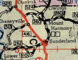 MD 523, 524 & 525 shown on a 1948 SRC map.


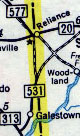 MD 531 shown on a 1958 map.

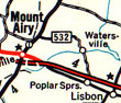 MD 532 shown on a 1954 map.

 MD 533 shown on a 1958 map. MD 3 is now MD 257, and 533 is now MD 254.

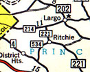 MD 534 shown on a 1954 map.


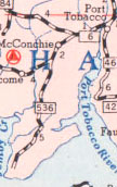 MD 536 shown on a 1955 SRC map.


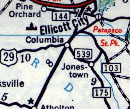 MD 539 shown on a 1958 SRC map.