|
| Routes: Interstates US Routes State Routes: | Home |
| Routes 800-819 (780-799) Prev (820-839) Next |
Quick Links: Marked Unmarked
Decommissioned |
|
Carroll
Linwood
New Windsor |
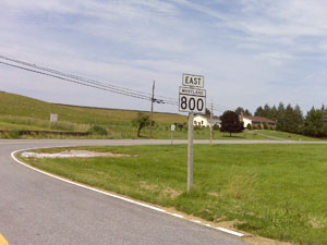
MD 800
5 sections
Status: One section (800D) is signed, the rest unsigned, associated with MD 75. The old alignment of MD 75 between Union Bridge and New Windsor. The SHA database does not have their names. East of MD 84, part of the old 75 was taken over by 84 itself, instead of becoming a section of 800. A small stub, MD 800A, branches from this section. Sections of MD 800:
|
800D
0.0 MD 751.6 MD 75 |
|
Queen Anne's
Irelands Corner
|
MD 801
· was Irelands Corner Rd
1.05 mi.; from MD 313 south of MD 290 north to MD 313 at Jim Davis Road
Status: Decommissioned 1987; transferred to Queen Anne's County maintenance. (SRC Min. 01-19-1988, Agreement 12-01-1987, Effective 12-01-1987) MD 801 was a loop westward off of MD 313 to Ireland's Corner, which is just south of Galena, where this road intersects with MD 290. |
|
|
Queen Anne's
Normans
|
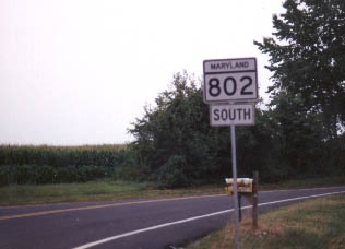
MD 802
· Batts Neck Rd
1.02 mi.; from MD 8 north back to MD 8.
Status: Signed north-south, associated with MD 8. A former piece of MD 8 that runs through a small residential area. Calling it an associated route of MD 8 is a little of a stretch, as it only appears once, not as a repeated bunch of little suffixed sections all up and down its path.
|
802
1.0 MD 80.0 MD 8 |
|
Cecil
Ginn's Corner
|
MD 803
· was Edgar Price Rd
1.53 mi.; from MD 299 to CO 333 and CO 333 to Delaware State Line
Status: Decommissioned 1979; transferred to Cecil County maintenance. (SRC Min. 12-27-1979, Agreement 12-26-1979, Effective 12-26-1979) Edgar Price Rd is a frontage east of 301 to reconnect its former alignment, now cut off by 301, to MD 299. The route description is taken verbatim from the RTDS. CO 333 is used as the county route designation for Edgar Price Rd. There was probably an intervening county section en route to the Delaware border. Dropped in one of the last actions of the 1970s. Its southern end parallels US 301 opposite the new weigh station. |
|
|
Washington
Smithsburg
Chewsville |
MD 804
2 sections
Status: One section (804B) unsigned, associated with MD 64, other section (804A) decommssioned 1985, transferred to Washington County maintenance. MD 804A was a section in Smithsburg dropped in 1985. MD 804B is the old alignment of MD 64 through Chewsville, where MD 62 still technically ends. Sections of MD 804: |
|
|
Washington
Rocky Forge
|
MD 805
1 remaining section
Unmarked, officially MD 805B, associated with MD 60. May not be open for access. MD 805 is what looks like a private driveway off MD 60 to Rocky Forge Rd. Sections of MD 805: |
|
|
Frederick
Thurmont
Frederick |
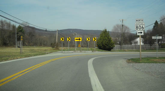
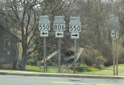
MD 806
5 remaining sections
Signed north-south, associated with US 15. MD 806 is our catch-all for old US 15 aligments and connectors. Though it's the portion north of Frederick to Thurmont that's signed, there was also once a piece of 806 south of Frederick. US 15 hadn't been rerouted along part of US 340 yet, so when it was routed along I-270 to the Frederick Freeway, that part north of I-270 became an 806 segment. When it did happen, the entire old US 15, including the new 806, became MD 85.
Sections of MD 806: Though it's not listed as under state maintenance, MD 806 is signed north of Thurmont, even being dual-signed with 550.
|
806R
1.0 Roddy Creek Rd0.0 MD 550
806A
3.0 Limits Thurmont3.0 ESM 2.3 Blue Mountain Rd 0.0 US 15 |
|
Allegany
Cumberland
|
MD 807
6 sections
Unsigned, associated with US 220. MD 807 comprises the old alignments, spurs and stubs of US 220, Bedford Road, north of Cumberland. Sections of MD 807: |
|
|
Carroll
Mount Airy
|
MD 808
· Main St [Mount Airy]
2 sections
Signed north-south, associated with MD 27. MD 808 is the old 27 through Mount Airy. Part of Main Street forms the Frederick-Carroll County boundary through the center of town, though the SHA data has Main Street as being entirely in Carroll County for inventory purposes. Sections of MD 808: |
808
2.3 0 MD 270.0 0 Ridgeville Blvd |
|
Cecil
Calvert
|
MD 809
2 sections
Status: MD 809 Decommissioned 1976; transferred to Cecil County maintenance. (SRC Min. 02-25-1976, Agreement 02-25-1976, Effective 02-25-1976) There are two entries for decommissioning of MD 809 (sans suffix), one in 1976, the other in 1979, with similar lengths and location writeups. Sections of MD 809: |
|
|
Prince George's
Broad Creek
Fort Washington White Hall Accokeek |
MD 810
· (frontages of MD 210)
11 sections
Status: Unsigned, associated with MD 210. MD 810 is used for the frontage roads either side of MD 210. It's relatively modern, so there aren't any old alignments of 210, not yet. The sections of 810 intermingle with the suffixed section of MD 210. Sections of MD 810: |
|
|
Cecil
Rising Sun
|
MD 811
· was Wilson Ave
0.19 mi.; from southern limits of Rising Sun north to MD 273
Status: Decommissioned 1979; transferred to Rising Sun municipal maintenance. (SRC Min. 01-08-1979, Agreement 01-05-1979, Effective 01-05-1979) MD 811 was downloaded to municipal maintenance in a 1979 swap for South Queen Street (MD 274 within Rising Sun) to be brought into state maintenance. |
|
|
Cecil
Cherry Hill
|
MD 812
2 sections
Status: Decommissioned 1979; transferred to Cecil County maintenance. (SRC Min. 11-22-1978, Agreement 11-22-1978) Number no longer assigned, was associated with MD 213 (MD 280) MD 812 is a former alignment of MD 213 through Cherry Hill, and MD 280 before that. As on other Cecil County routes, there is plenty of room to bypass mildly developed hamlets like Cherry Hill with a new alignment. Sections of MD 812: |
|
|
Wicomico
Sharptown
Cecil
West Nottingham
Clearview |
MD 813
1 remaining section
Status: MD 813F Unsigned, associated with MD 313. Status: MD 813 in Cecil County Decommissioned 1979; transferred to Cecil County maintenance. (SRC Min. 12-27-1979, Agreement 12-26-1979, Effective 12-26-1979), was associated with MD 276. Although there is an extant section of 813 in Wicomico County (numbered similar to 313), the number was mostly used for an old piece of MD 276 in Cecil County. Sections of MD 813: |
|
|
Frederick
Creagerstown
|
MD 814
· (no name)
0.29 mi.; from road end east to road end.
Status: Unmarked, associated with MD 550. MD 814 parallels MD 550 on the northeast side. Its only connection with another road is Penterra Manor Lane. |
|
|
Wicomico
West Salisbury
|
MD 815
· Old Quantico Rd
0.72 mi.; from MD 349 east back to MD 349
Status: Signed north-south. It's mostly east-west geographically. MD 815 is an old alignment of MD 349, bypassed due to a tight bend. Though it's inventoried east-west, MD 815 is signed north-south. Eastward is signed north, westward is signed as south. The route east of Parsons Road may be one way westbound; it's looks more like a ramp on the map, and all turn movements onto MD 349 can be done from Parsons Rd. |
815
0.0 MD 3490.0 Parsons Rd 0.0 MD 349 |
|
Dorchester
Madison
|
MD 816
· was Old Madison Rd
0.88 mi.; from MD 16 at Madison to MD 16 E of Madison
Status: Decommissioned 1970, transferred to Dorchester County maintenance. Number no longer assigned, was associated with MD 16. (SRC Min. 05-07-1970, Agreement 05-07-1970, Effective 12-01-1970). Became CO 369 according to the RTDS, so that gives us: Old Madison Rd. In the current SHA database, it loops with MD 16 as the old 816 did. Madison is on the Little Choptank River along MD 16, west of Church Creek (where MD 16 splits with MD 335.) |
|
|
Caroline
Linchester
Preston |
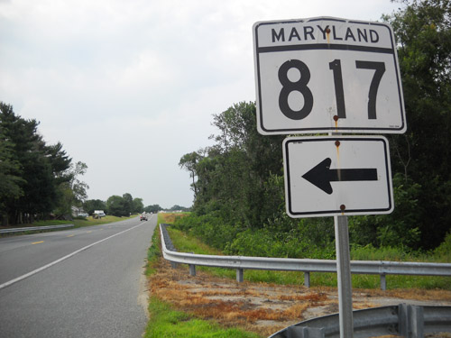
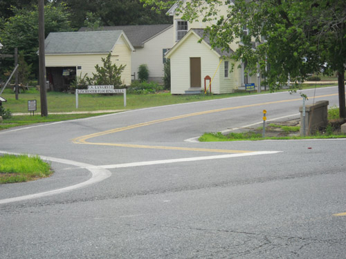
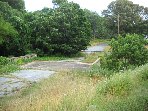
MD 817
· Linchester Rd, Langrell Rd
2 sections
Status: MD 817A signed, MD 817B unsigned, one bridge abandoned. MD 817 consists of two sections of MD 16-331 through Linchester, south of Preston. Sections of MD 817:
|
817A
0.5 MD 16-3310.4 MD 331A 0.0 MD 16-331 |
|
Worcester
Berlin
|
MD 818
· Main St [Berlin]
2.62 mi.; from US 113 north through Berlin back to US 113.
Status: Signed north-south, associated with US 113. Route 818 is the old, pre-bypass routing of US 113 through Berlin. The number probably dates from the time of construction of the new 4-lane US 113 east of town (late 60s?), relieving the burden of eastern Delmarva north-south traffic through Berlin. Sections of MD 818: |
818
2.6 US 1132.2 US 50 1.5 MD 346 0.9 MD 376 0.8 MD 374 0.8 MD 375 0.1 MD 818A 0.0 US 113 |
|
Dorchester
Reids Grove
|
MD 819
· Reids Grove Rd
0.19 mi.; from MD 331 south back to MD 331.
Status: Unsigned, associated with MD 331. Near Reid Rd and Maiden Forest Rd, running just west of MD 331, halfway between Vienna and Rhodesdale. |
|