
|
|
Home | Interstates | US Routes | MD Routes | Road Pics | About | Links |
| Routes 1-6 (980-999) Prev (7-11) Next |
Quick Links: Marked Unmarked
Decommissioned |
|
Prince George's
Howard
Baltimore
Baltimore City
Baltimore
Harford
Cecil
|
US 1
81.00 mi. in Maryland; from DC line near Bladensburg north to PA line near Rising Sun
Status: Marked north-south. US 1 has its own page in the US highway section. |
|
|
|
MD 1
· was Baltimore-Washington Blvd.
current US 1
Status: Entire route now US 1 or Alt US 1. Although created in 1908, probably never signed as a state route; it was unlikely that state routes were signed prior to the creation of the US Highway system in 1926. State Route 1 is mentioned in several places as Baltimore-Washington Blvd, although it is very unlikely that it was ever signed as MD 1. It was of course signed as US 1 beginning with the 1926 inception of the US highway system. From the 1908 Code of the Public Local Laws of Maryland:
[link]
|
|
|
Baltimore City
Anne Arundel
Brooklyn
Glen Burnie Harundale Pasadena Severna Park Arnold Annapolis Parole Edgewater Steuart Cor. Birdsville Marriott Hill Harwood Mt. Zion (Lothian) Tracy's Ldg. Calvert
Mt. Harmony
Sunderland Stoakley Prince Frederick Lusby Solomons |
MD 2
80.56 mi.; from US 1 in Baltimore south to Solomons
Island in Calvert Co.
Status: Marked north-south. NHS: Between MD 10 and US 50/301, and entire length of MD 2/4. Associated Secret-Obscure Routes: 393 524 553 648 686 711 765 773 778 915 MD 2 'begins' at US 1, North Avenue in Baltimore along St. Paul St. southbound, and Calvert St. northbound. It passes along the west side of the Inner Harbor, switching over to Light St. and then Hanover St. south of the harbor. The Hanover St. drawbridge (now Vietnam Veterans Mem. Bridge) over the Middle Branch of Baltimore Harbor was completed in 1917. Hanover gives way to Potee (pronounced poh-TEE) St., becoming Ritchie Highway at the city limits. Ritchie Highway was opened around 1940, replacing old Baltimore-Annapolis Blvd., now MD 648. Although running in a straight line for from Glen Burnie down to the US 50 junction, commercial development along its entire length necessitated freeway access from Baltimore to Annapolis. The original plan was to extend MD 10 southward, but the path of least resistance would prove to be the MD 3-178 corridor, now I-97. The sheer number of traffic lights for shopping center entrances make the speed limit unattainable on many segments. MD 2 runs concurrently with US 50-301 between Ritchie Hwy. and Solomons Island Rd. Prior to that, 2 ran into town along current 450 (King George St., College Ave., West St.) and then along Old Solomons Island Road (now semi-secret MD 393). South of Annapolis, the situation is more tranquil. Route 2 traverses Solomons Island Rd. from US 50 south to the 2/4 split, then going south on Southern Maryland Blvd. (Louis Goldstein Hwy.) as both 2 and 4 almost the entire length of Calvert County. This portion has been entirely upgraded to 4 lane divided; the old 2-lane road is signed MD 765. Before MD 4 crosses the Thomas Johnson Bridge, 2 splits off for its entrance into Solomons Island. |
2
80.6 US 180.3 I-83 4 79.4 US 40 77.3 I-95 54 75.3 I-895 7 75.2 MD 173 74.8 AA-BC Line 74.8 MD 170 73.7 MD 171 72.9 I-695 3 72.8 MD 711 72.4 I-895sp 6b 72.0 MD 710 71.6 MD 3 Bus 71.2 MD 270 69.8 MD 648 67.6 MD 177 67.4 MD 100 16 65.7 MD 10 63.4 MD 648 62.8 MD 648 58.9 MD 648 57.7 MD 648 57.3 27 MD 450 57.3 27 US 50-301* 55.1 24 MD 70 54.0 23 US 50-301* 54.0 MD 450 53.4 MD 393 53.1 MD 665 51.9 MD 553 51.1 MD 253 50.1 MD 214a 49.6 MD 214 42.8 MD 255 41.5 MD 408 41.5 MD 422 38.2 MD 258 37.7 MD 256 35.8 MD 423 35.7 MD 778 33.4 CV-AA Line 32.7 MD 260 29.1 MD 262 28.9 MD 4* 26.3 MD 524 25.6 MD 524 23.4 MD 263 20.6 MD 402 18.3 MD 765 17.6 MD 506 16.0 MD 765 16.0 MD 264 5.7 MD 497 4.6 MD 760 1.5 MD 4* 0.2 MD 749 0.1 MD 749 0.0 BSM |
|
Baltimore City
|
MD 2 Truck
· Key Hwy., McComas St.
South Baltimore
Status: Not signed. Shown on SHA maps, but nowhere else. Not signed by Baltimore City but won't officially call it 'secret,' given the spotty signage of City routes. Bypasses a residential segment of Hanover St., directing truck traffic through more industrial areas east of Federal Hill. Traverses McComas St., which parallels the I-95 tunnel approach, then turning north onto Key Highway at I-95 Exit 56, then west back to Light St. north of Federal Hill, south of downtown Baltimore. Back in 1954, when US 301 ran up the MD 2 corridor into Baltimore, a map shows this route as Truck US 301. |
|
|
Prince George's
Bowie
Priest Bridge Anne Arundel
Crofton
Conaways Millersville |
MD 3
· Robert Crain Hwy.
9.56 mi.; from US 50-301 interchange to I-97 Exit 7 / MD 3
2 interchange.
Status: Marked north-south. NHS: Entire remaining length between I-97 and US 50/301. Associated Secret-Obscure Routes: 932 761 978 Robert Crain Highway from Glen Burnie south to Charles County was officially opened October 22, 1927, completing a Baltimore-Southern Maryland connection. It was the first road in Maryland to be built on a totally new alignment by the State Roads Commission; previous projects consisted of paving and/or widening roads that had been around since colonial times. The opening ceremony was unsurpassed in fanfare before or since. A monument stands in Upper Marlboro, along the original 1927 route, long since bypassed and for a while numbered MD 761. Route 3 originally ran from Baltimore south along the current US 301, veering southeastward along what is now MD 257 to its end near Cobb Island. All but this southern portion became US 301 with completion of the Harry W. Nice Bridge across the Potomac River to Virginia, and Route 3 designation was used only for the southern portion, along with some old alignment in Charles County. As US 301, it was upgraded from 2-lane to 4-lane dual in 1954. The median between carriageways is up to 300 feet wide north of Crofton and MD 424, allowing development in the median itself. A plethora of fast-food joints occupy the median in this segment. The Glen Burnie Bypass (the part of I-97 north of Exit 12), the Baltimore Beltway (I-695), and the Baltimore-Washington Parkway / Russell St. (MD 295) took the northern portion of the route off surface streets. Previously, US 301 / MD 3 followed Baltimore-Annapolis Blvd. into Baltimore City, then turning northwest onto Monroe St., where it ended at US 1 in southwest Baltimore. Old Crain Hwy. into Glen Burnie became Business MD 3; B&A Blvd. became MD 648. Sometime between 1954 and 1961, US 301 was duplexed with US 50 to the Eastern Shore, leaving the portion north of US 50 as MD 3 again. In the late eighties, the southbound right-of-way was widened for the new I-97, while the northbound (original?) lanes were reverted to two-way service traffic. All Route 3 signs were removed on the multiplexed I-97 portion in 1995. Although Business 3 still stands in Glen Burnie, at the I-97 merge is a white sign with shield: "3 ENDS." MD 3 is left with only the 9 miles between I-97 and US 50-301. There are still signs reading "TO MD 2 & 3" on streets in Baltimore City. Although SHA does not maintain routes in the city, Lombard and Pratt Streets in the downtown area are still shown as (unsigned) Truck MD 3 on its official maps, a small reminder of its past importance. |
3
9.6 I-97 78.9 MD 32 8.1 MD 175 4.7 MD 424 2.7 MD 450* 2.5 PG-AA Line 2.2 MD 450* 1.6 MD 976 1.3 MD 976 0.0 US 50-301 13 |
|
Anne Arundel
Glen Burnie
|
MD 3 Business
· Old Crain Hwy.
5.08 mi.; from I-97 Exit 12 north to Ritchie Hwy. (MD 2),
Glen Burnie
Marked north-south. Business MD 3 came into being when mainline 3 (US 301 then) was diverted to the new Glen Burnie Bypass freeway (now I-97). Even now, with 3 officially 'ending' at I-97 Exit 7, well short of contact with this stretch, the Business 3 designation remains. Business 3 is, as far as I know, the only business route in the U.S. not to touch its parent main route. Is this the case anywhere else? I have a picture of the 'End 3' sign on I-97 coming soon. |
3 Bus.
0.0 BSM0.5 I-97 12 2.5 MD 174 3.3 MD 648 4.7 MD 270 5.1 MD 2 |
|
Baltimore City
|
MD 3 Truck
· Lombard & Pratt Streets
Downtown Baltimore
Status: Not signed. See caveats about Baltimore City and Truck MD 2. Another Baltimore City route that appears only on SHA maps. Pratt St. is the first street along the harbor, one way eastbound. Lombard is a block north and one way westbound. Until the early seventies the one-way directions were reversed. |
|
|
Prince George's
Suitland
Meadows Upper Marlboro Anne Arundel
Bristol
Calvert
Lyons Crk.
Dunkirk Chaneyville Stoakley Prince Frederick Lusby St. Mary's
Town Creek
Leonardtown |
MD 4
64.85 mi.; from DC Line southeast to MD 5 near Leonardtown
Status: Signed north-south everywhere now. PG County portions were signed east-west. NHS: Entire length except between MD 235 and MD 5. Associated Secret-Obscure Routes: 717 725 761 One of the original state roads, Marlboro Pike, MD 4 once ran strictly east-west from DC through Upper Marlboro, then following what is now MD 408 to its end at MD 2 in Mt. Zion (Lothian). Sometime between 1962 and 1972, 4 was diverted to run along Southern Maryland Blvd. (then MD 416), and duplexed with MD 2 as 416 had been for almost the entire length of Calvert Co. At the southern tip of Calvert Co., 2 and 4 met a simultaneous end. This changed with the construction of a bridge across the Patuxent River. Around 1980, MD 4 was extended over the new Gov. Thomas Johnson Bridge onto St. Andrews Church Rd. in St. Mary's Co., while 2 heads to its southern terminus in Solomons. 765 794 980Interesting Signage: At the Capital Beltway, the guide signs for MD 4's exit are signed "NORTH / WEST" and "SOUTH / EAST." There's no similar case elsewhere in Maryland. |
4
64.6 DC Line62.5 MD 458 60.0 I-95/495 11 59.0 MD 337 56.9 MD 223 52.6 MD 717 52.0 US 301 51.1 MD 726 50.6 AA-PG Line 50.1 MD 408 47.3 MD 794 45.8 CV-AA Line 45.6 MD 260 37.6 MD 262 37.0 MD 4* 34.2 MD 524 33.5 MD 524 31.3 MD 263 28.5 MD 402 26.2 MD 765 25.5 MD 506 23.9 MD 765 23.9 MD 264 13.6 MD 497 12.5 MD 760 10.1 MD 2* 9.4 SM-CV Line 6.1 MD 235 0.0 MD 5 |
|
Prince George's
District Heights
|
Business MD 4
from DC line to near I-95/495 Exit 11
Status: Decommissioned. This was old mainline 4 through District Heights until P ennsylvania Ave. was extended into Maryland as a 4-lane divided. Business 4 followed the old alignment out to where Marlboro Pike was closed to make way for the Capital Beltway. It appears in the 1961 and 1962 maps. |
|
|
Prince George's
T. B.
Charles
Mattawoman
Waldorf Beantown Bryantown Hughesville St. Mary's
Newmarket
Mechanicsville Helen Morganza Loveville Leonardtown Redgate Callaway Great Mills Park Hall St. Mary's City St. Inigoes Ridge Scotland Point Lookout |
MD 5
· Branch Ave., Point Lookout Rd.
75.71 mi.(before Waldorf bypass) 74.34 mi.(after); from
DC line south to Point Lookout
Status: Marked north-south. NHS: From DC line south to MD 235. Associated Secret-Obscure Routes: 326 379 415 584 631 637 943 A major link between Washington and Southern Maryland, MD 5 provides a vital connection to US 301, with which 5 is duplexed in the Waldorf area. Pending problems with the Wilson Bridge will make it ever the more important. MD 5 is being moved over the course of MD 205 east of Waldorf, providing a bypass of sorts for Southern Maryland traffic. The Hughesville Bypass for MD 5 was opened August 8, 2007. This makes three business routes for MD 5. |
5
74.3 DC Line74.1 Suitland 73.8 MD 637 72.5 MD 414 71.0 I-95/495 7 69.8 MD 337 62.1 MD 373 61.6 US 301* 59.1 CH-PG Line 58.9 US 301* 55.7 MD 5 Bus 52.0 MD 488 47.0 MD 231 45.2 SM-CH Line 44.0 MD 863 43.8 MD 863 42.8 MD 6 42.6 MD 236 38.3 MD 235 35.1 MD 238 33.7 MD 242 32.6 MD 247 28.8 MD 234 28.1 MD 243 28.0 MD 943 26.7 MD 5 Bus 26.7 MD 245 26.0 MD 5 Bus 25.5 MD 4 24.7 MD 244 18.7 MD 249 17.5 MD 471 17.2 MD 246 13.3 MD 489 11.2 MD 584 10.9 MD 584 5.0 MD 235 0.0 BSM |
|
Charles
Waldorf
|
MD 5 Business (Waldorf)
· Leonardtown Rd.
1.80 mi.; from
US 301 at MD 228 junction southeast to MD 5
Status: Marked without directional banners, only 'Business' above marker. After MD 5 was routed northeast of Waldorf along Mattawoman-Beantown Rd (was MD 205) to reach US 301, this older portion was designated Business MD 5. As far as I know, Business 5 is not signed on US 301 between these two, so this business route is technically a spur of MD 5. Other options included swapping with MD 205, or to extend MD 228 (across from US 301 at its western end) east through Waldorf to the new MD 5. This Business MD 5 is signed with standard black signage with a separate 'business' banner. above the marker. A different convention is used 10 miles down the road in Hughesville. There are still a few signs where 'business' has not yet been added. NHS: Entire length. The only case I know of NHS status for a business route. Adjacent MD 228 just across US 301 is also NHS. Associated Secret-Obscure Routes: 625 |
5 Bus.
1.8 MD 2281.8 US 301 1.6 MD 925 0.0 MD 5 |
|
Charles
Waldorf
|
MD 5 Business (Hughesville)
· Leonardtown Rd.
1.36 mi.; from MD 5 north to MD 5 either side of Hughesville
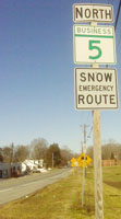
Status: Marked north-south, with new green 'Business' state marker. In official SHA records, this route is designated MD 625.
This latest Business 5 was created after Hughesville was bypassed to the east in 2007, relieving this formerly congested stretch of 5 near MD 231. Further widening in town was not possible. This newest Business MD 5 is signed with a one-piece green marker with 'BUSINESS' replacing 'MARYLAND' in the top bar. Since there's no separate extra business banner, this makes for a quick swap. Directional banners remain the old black. The green marker is also used alone on guide signs along the new MD 5. Though I've seen this treatment before with US shields, this is the first time I've seen a state marker done this way. Associated Secret-Obscure Routes: 625 |
5 Bus.
1.4 MD 50.6 MD 231 0.0 MD 5 |
|
St. Mary's
Leonardtown
|
MD 5 Business (Leonardtown)
· Fenwick St, Washington St
0.96 mi.; from MD 5 east of Leonardtown west/north to MD 5 at MD 245 north of Leonardtown.
Status: Signed in two places, both only visible from southbound/eastbound direction. This short business route into Leonardtown runs west along Fenwick St to the center of Leonardtown, then north on Washington St, back to MD 5 at its intersection with MD 245. It's signed with standard black shields with Business banner separate above. (thanks to Brian Leggett for signage info) Now only if they can sign it in the other direction. The rest of Washington St south of Fenwick St. to the waterfront was once MD 326. Associated Secret-Obscure Routes: 326 |
5 Bus.
1.0 MD 2451.0 MD 5 0.6 Washington St 0.0 MD 5 |
|
Charles
Riverside
Nanjemoy Doncaster Ironsides Hill Top Welcome McConchie Port Tobacco La Plata Newtown Dentsville Dubois St. Mary's
Newmarket
Huntersville Oraville Turner |
MD 6
· Riverside Rd., Charles St., Newmarket-Turner Rd.
47.38 mi.; from Riverside east to MD 235, Turner
Status: Marked east-west. MD 6 is the slacker among the single digits. It just meanders along the Southern Maryland tobacco country. It does cross US 301 at La Plata, but it takes its merry old time getting there. Unlike 2 through 5, Route 6 is still entirely a two-lane road. Must make for a good drive; have to try it one weekend. Route 6 has been there since the beginning of state numbering, and in the same alignment. Can't think of any major reroutings or bypasses. There aren't many routes left where that's the case. The proper names for the roads making up MD 6 were mostly of the hyphenated variety, indicating the two towns connected. (west to east): Riverside Rd., Doncaster-Grayton Rd., La Plata-Doncaster Rd., La Plata-Newmarket Rd., Newmarket-Turner Rd. With the new enhanced 911 system statewide, street addresses are a necessity, as opposed to rural route and box numbers, so the roads were renamed. West of La Plata, 6 is called Riverside Rd., east of La Plata, Charles St. Newmarket-Turner Rd. remains on the books in St. Mary's County. |
6
0.0 End0.7 MD 224 5.8 MD 425 11.0 MD 344 13.9 MD 425 25.2 US 301 26.5 488 37.8 CH-SM Line 39.1 MD 5 47.4 MD 235 |


 New Business 5 marker (picture 12/27/09)